
Services
Sediment Sampling
Sea Surveyor owns and operates two (2) vibratory corers (Vibracores) capable of collecting continuous core samples of 5’, 10’, 15’, 20’, or 30’ lengths. The sediment cores are contained within clear, 3.5”-diameter, chemically-inert liners that can be cut into...
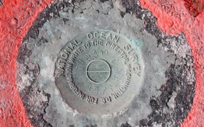
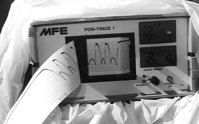
Sea Level Monitoring
NOAA-Compliant Tide Station Submittals Include: Transmittal letter Data Checkoff List Tide Station Xpert Site Reports Chartlets and USGS Quad Map Permits and Property Owner Agreements Benchmark Descriptions & “To-Reach” Statements Sensor Elevation Drawing Sensor...
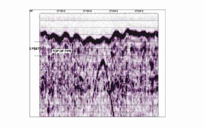
Pipeline Surveys
Sea Surveyor has over 25-years experience at surveying submerged pipelines located on, or buried beneath, the seafloor. We use Sophisticated geophysical sensors to determine a pipeline’s exact location and depth-of-burial, including side-scan sonar,...
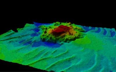
Paleochannel Survey
Paleochannels are ancient riverbeds created when sea level was lower that now lie buried beneath the seafloor, filled with aggregate (sand/gravel/cobbles). Sea Surveyor uses sophisticated seismic reflection and refraction techniques to map buried paleochannels....
Oceanography
Sea Surveyor owns and operates numerous types of sophisticated oceanographic sensors that monitor tides, waves current speed and direction, and diffusion/dispersion. Typical applications include: CURRENT MONITORING: • InterOcean S-4 meters are used to measure...
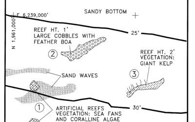
Marine Vegetation Surveys
Sea Surveyor has been conducting marine vegetation surveys for environmental companies and regulatory agencies since the early 1990's. With our extensive experience and new high-resolution sonar equipment, Sea Surveyor can produce highly-accurate charts showing the...
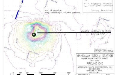
Marine Magnetometer
The Marine Magnetometer is the best tool for locating sunken ships, lost anchors, buried pipelines, and other underwater objects containing ferrous metal that disrupt the Earth’s magnetic field. Sea Surveyor uses a GEOMETRICS Model 882 marine magnetometer to...
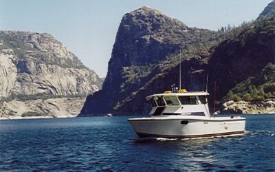
Lakes and Reservoirs
Sea Surveyor has surveyed over 50 lakes and reservoirs in 5 Western States, ranging in elevation from sea level to over 7,000’. Our tow vehicles have moved our survey boats over 9,000’ mountain passes, and launched the boats in lakes without boat ramps. Our vessel’s...
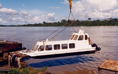
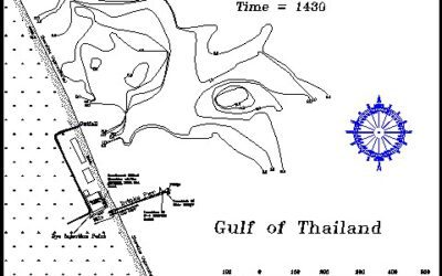
International Surveys
Sea Surveyor has 23-years of experience at conducting marine surveys at remote, international locations. We have successfully conducted oceanographic and marine geophysical surveys on 5 of the earth’s 7 continents. We can provide quick mobilization and on-site...
Hydrographic Surveys
Class 1 Hydrographic Surveys Sea Surveyor conducts hydrographic surveys using single-beam and multibeam depth sounders with hull-mounted transducers. We use the most stringent Class 1 standards required by the U.S. Army Corps of Engineers for pre- and post-dredge...
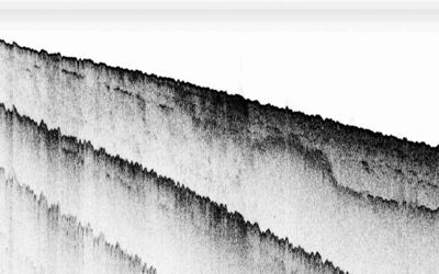
Marine Geophysical Investigations
Geological Mapping Sand Resource Mapping Pipeline Inspections Underwater Archaeology Vegetation Survey Site Characterization Sea Surveyor is expert at using sophisticated marine geophysical sensors to make reliable maps of the seafloor and subbottom geology for: ...
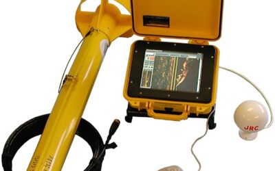
MINI-CONE CPT
Sea Surveyor uses a lightweight Mini-Cone CPT to rapidly profile soils characteristics to a penetration depth of 6m (20-feet) below the seafloor. Enclosed within a self-righting seabed cage, the Mini-Cone CPT straightens and pushes a coiled rod into the sediments. ...