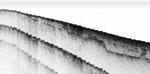
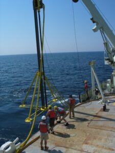
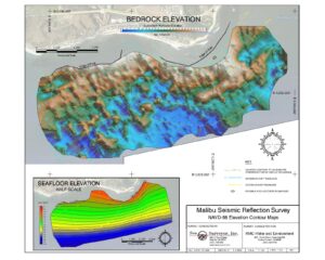
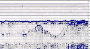
 Paleochannels are ancient riverbeds created when sea level was lower that now lie buried beneath the seafloor, filled with aggregate (sand/gravel/cobbles). Sea Surveyor uses sophisticated seismic reflection and refraction techniques to map buried paleochannels. Paleochannels are unique, with each having different subbottom layering, thicknesses and aggregate compositions. Sea Surveyor uses a combination of CHIRP, boomer, and sparker systems to map buried paleochannels. After completing the seismic reflection survey, Sea Surveyor interprets the subbottom profiles and creates an isopach (sediment thickness) map. Elevation contour maps of the seafloor and subbottom layers are prepared in graphic and digital formats. Seismic reflection surveys are ground-truth’ed using an ALPINE vibracore to collect continuous 20’ to 40’ long core samples of the aggregates within the paleochannel.
Paleochannels are ancient riverbeds created when sea level was lower that now lie buried beneath the seafloor, filled with aggregate
Surveyor uses sophisticated seismic reflection and refraction techniques to map buried paleochannels. Paleochannels are unique, with each having different subbottom layering
After completing the seismic reflection survey, Sea Surveyor interprets the subbottom profiles and creates an isopach (sediment thickness) map.