
Completion Date: 2012
Contract Value: $25K
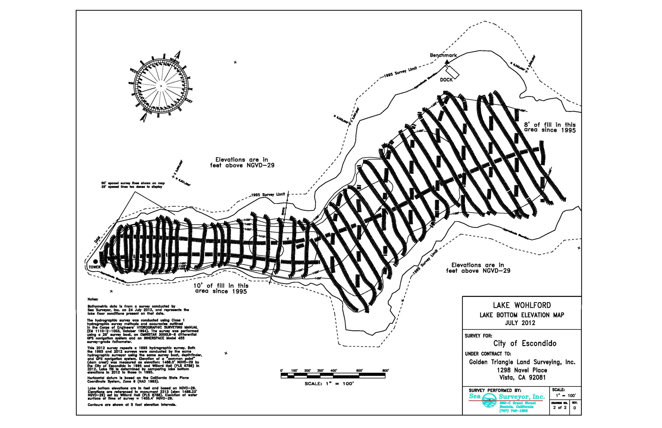
As part of a Federal- and State-funded project to upgrade seismically-unsafe dams, the City of Escondido contracted Sea Surveyor, Inc. to map the bottom of Lake Wohlford in San Diego County, California. The purpose of the survey is to map the elevation of the lake’s original, hard bottom that is now buried under 30’ or more of lake sediment deposits.
Sea Surveyor, Inc. conducted a Class 1 hydrographic survey of Lake Wohlford using methods and accuracies outlined in the Corps of Engineers’ HYDROGRAPHIC SURVEY MANUL (EM-1110-3, 2004).. This 2012 hydrographic survey is a repeat of a Lake Wohlford survey conducted by Sea Surveyor in 1995, 17 years previous. The 1995 and 2012 lake surveys are exactly comparable, conducted by the same hydrographic surveyor (Mr. Steve Sullivan of Sea Surveyor, Inc.) using the same survey vessel (26’ BETTY JO), depthfinder (INNERSPACE Model 448), and GPS navigation system (TRIMBLE 4000-SSI). Registered land surveyors confirmed that the 1995 and 2012 surveys used the same vertical datum (NGVD-29) and horizontal coordinate system (CA Zone 6, NAD83).
The hydrographic survey found 8’-10’ of sediment has filled Lake Wohlford during the intervening 17-years (1995 to 2012) between surveys.
While conducting the hydrographic survey, Sea Surveyor used a CHIRP seismic reflection system to collect subbottom profiles that imaged the original lake bottom buried beneath 30’ or more of accumulated sediments. Engineering-quality AutoCAD maps at scale 1”=100’ were delivered, including:
• a bathymetric contour chart of Lake Wohlford,
• a lake bottom elevation contour map referenced to NGVD-29,
• an isopach (sediment thickness) contour map,
• subbottom reflector elevation map referenced to NGVD-29, and
• dredge volume computations for selected cofferdam placement sites.
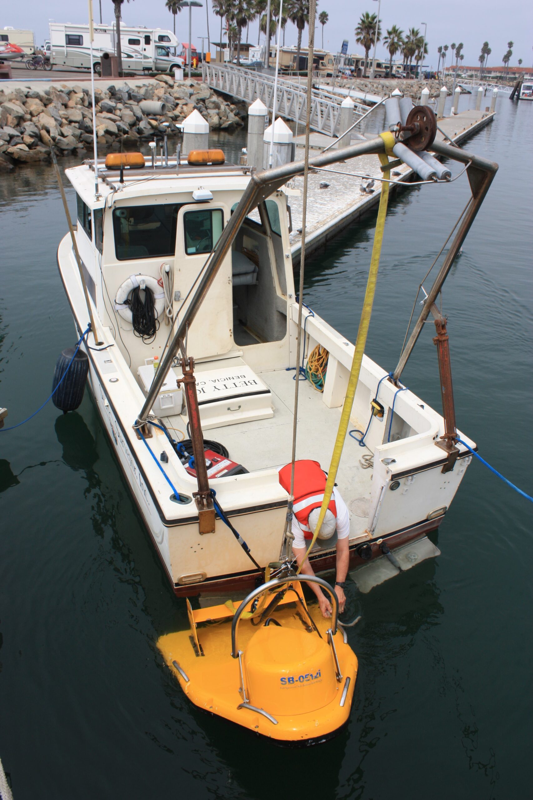
CHIRP Subbottom Profiler
CHIRP Subbottom Profiler
2012Bathymetric Chart of Lake Wohlford, California
2012 Bathymetric Chart of Lake Wohlford, California