
Completion Date: 2013
Contract Value: $ 120K
Vail Lake in Riverside County has accumulated 15’of silt (400,000 cubic yards) near the Dam that needs to be dredged, and 4’-5’ of silt (2.5-million cubic yards) covers the remaining lake bottom. To support future lake dredge plans, Sea Surveyor conducted a hydrographic survey and subbottom profiling survey to quantify the lake sediments available for dredging and collected sediment core samples for analytical testing of standard pollutants.
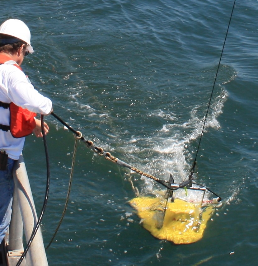
Sea Surveyor conducted the hydrographic survey using a 25’ boat, GPS navigation and a survey-grade depthfinder. While surveying the Lake at 100’ grid intervals, the boat also towed a CHIRP subbottom profiling system to measure the thickness of lake sediments. Deliverables from the survey include a bathymetric map of lake bottom elevations, an updated lake capacity cure, and an Isopach (sediment thickness) Map interpreted from the CHIRP subbottom profile data. Sediment cores of 11’-length were collected at 24 locations in Vail Lake from a portable vibracore barge. Sediment cores were photographed, logged, and composited into 5 samples for analytical laboratory testing of standard pollutants. Sediment cores confirmed the accuracy of the Isopach (sediment thickness) Map.
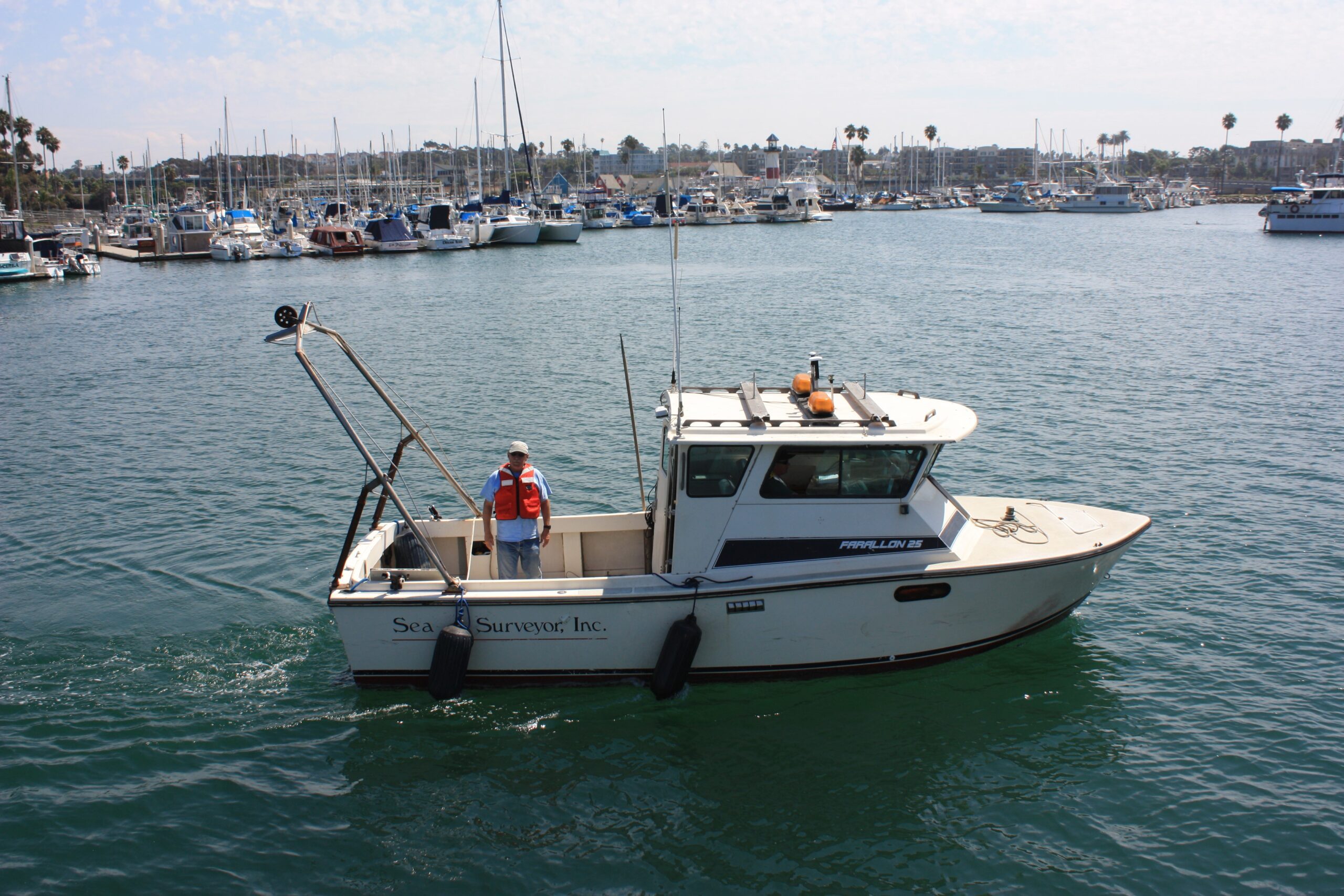
25’ Survey Vessel conducted hydrographic survey and towed CHIRP subbottom profiler
25’ Survey Vessel conducted hydrographic survey and towed CHIRP subbottom profiler
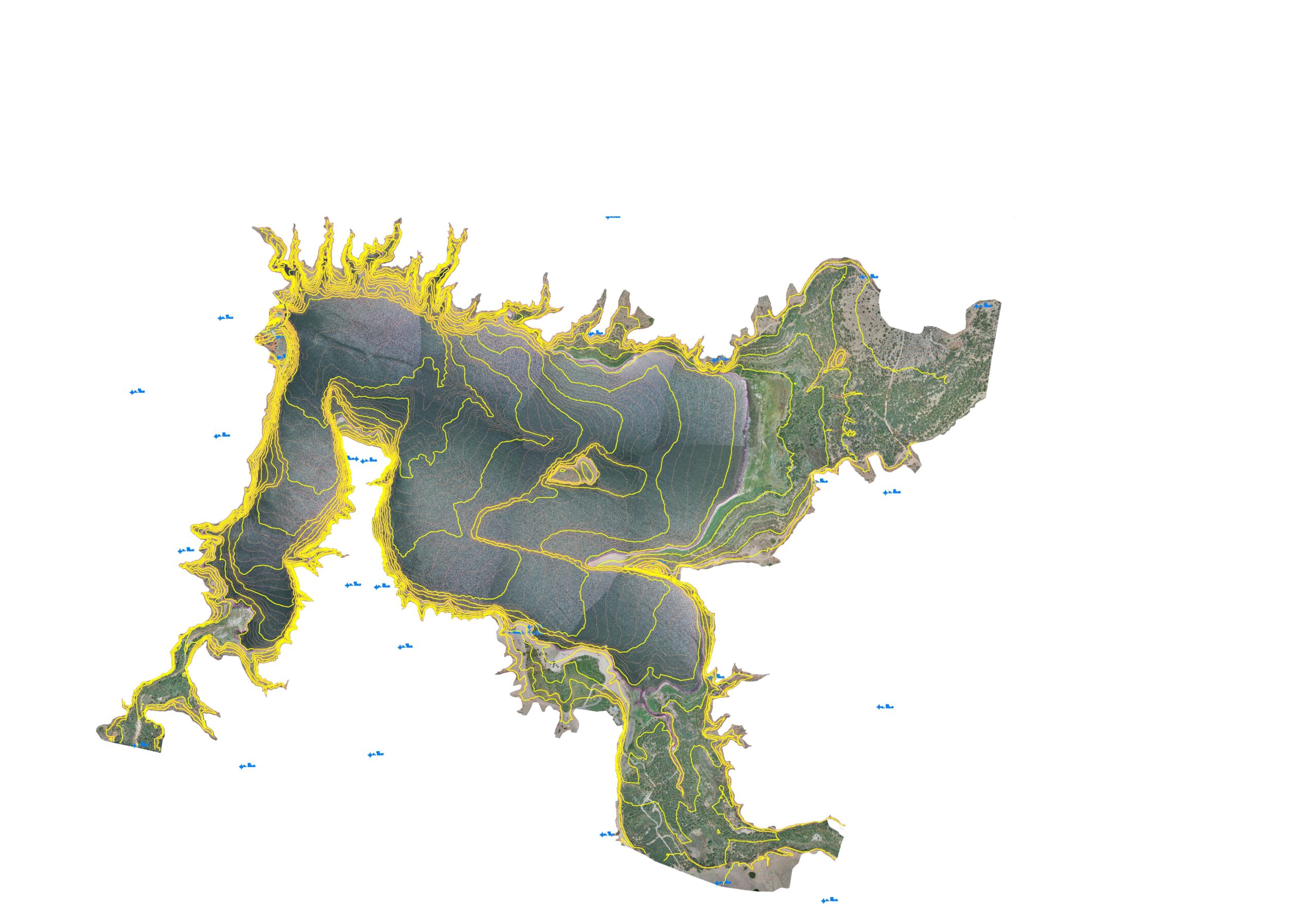
Bathymetric Lake Map
Bathymetric Lake Map
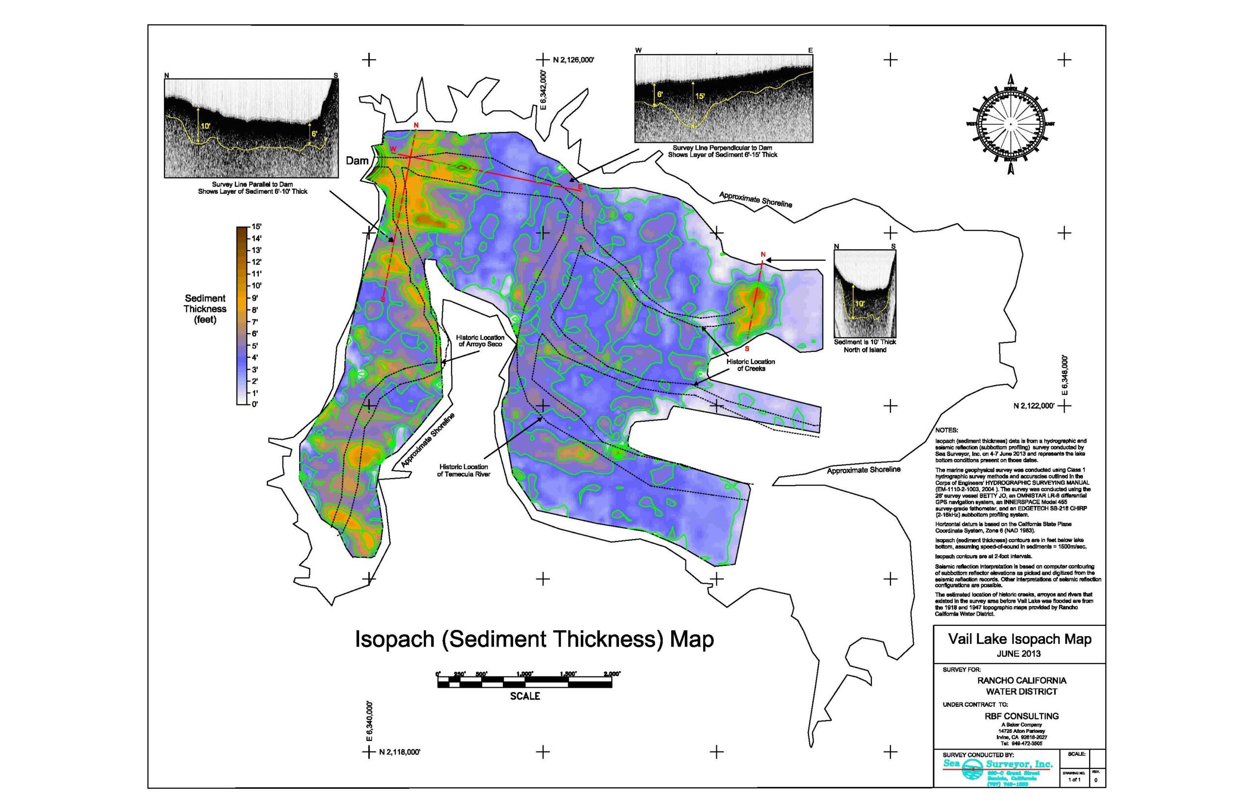
Isopach Map displays the thickness of lake sediments
Isopach Map displays the thickness of lake sediments
Towfish is a CHIRP subbottom profiler
Towfish is a CHIRP subbottom profiler
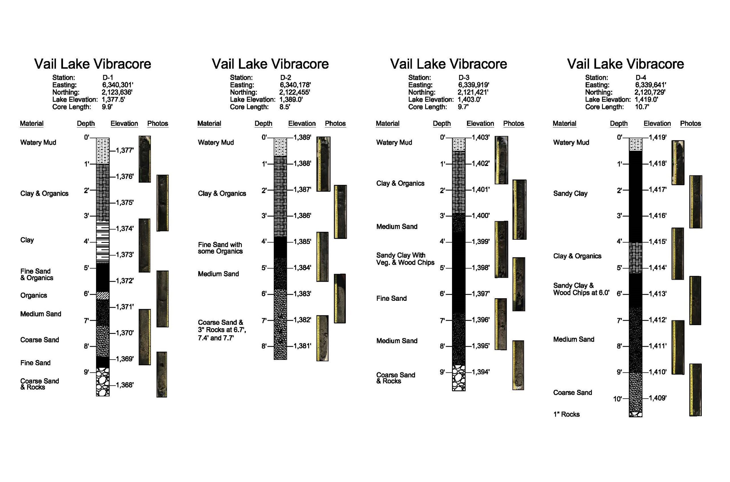
Vibracore collects 11’ cores that are lab tested and logged
Vibracore collects 11’ cores that are lab tested and logged
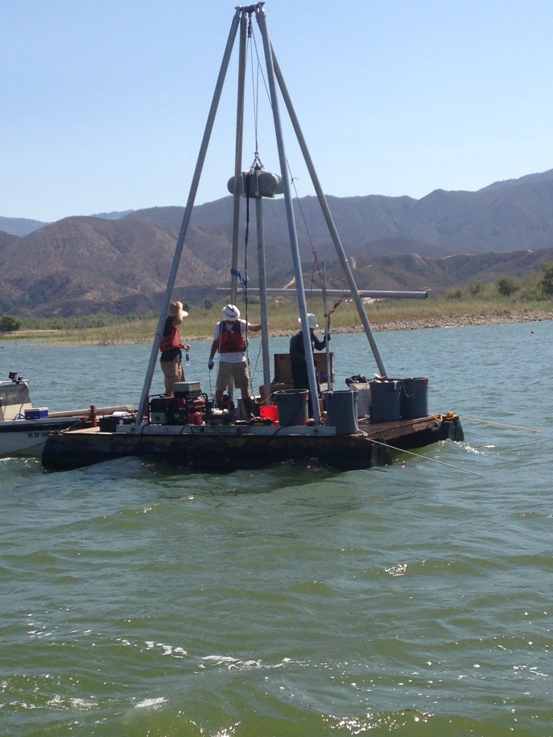
Vibracore
Vibracore