
Client: U.S GEOLOGICAL SURVEY
Completion Date: 2005
Contract Value: $382K
In 2005, Sea Surveyor conducted an intensive, bank-to-bank hydrographic survey of South San Francisco Bay. Soundings were collected for the next-generation of nautical charts being prepared by NOAA and for modeling being conducted by USGS for the Salt Pond Restoration Project. The entire 250 square miles of South Bay were surveyed, as well as Coyote Creek and 4 sloughs. To complete the field survey in 90-days, survey operations were conducted 24-hours per day.
Soundings were collected at 1m intervals along survey lines spaced at nominal 100m intervals using a single-beam, 200kHz transducer with differential GPS navigation and vessel motion-sensors. Various survey vessels were utilized, including a 29’ vessel for open-bay surveys, a 26’ vessel for slough surveys, and a 14’ vessel for creek surveys.
A 50kHz seabed classification system was used to prepare a map showing the acoustic properties and likely composition of surficial sediments in South San Francisco Bay.
To correct the soundings for tidal fluctuations, Sea Surveyor installed four (4) acoustic tide gauges provided by NOAA. The acoustic tide gauges measure tide height at 6-minute intervals and broadcasts the data to the Internet via the GOES satellite system. NOAA divided South San Francisco Bay into “tidal zones” with each zone having a time and height corrector based upon the 4 tide gauges. Sea Surveyor calibrated the tide gauges to historic benchmarks before and after the hydrographic survey using fast-static GPS and optical land surveying techniques. Sea Surveyor installed new NOAA benchmarks on the San Mateo and Dumbarton Bridges to act as a reference to tie the hydrographic survey to all past and future surveys
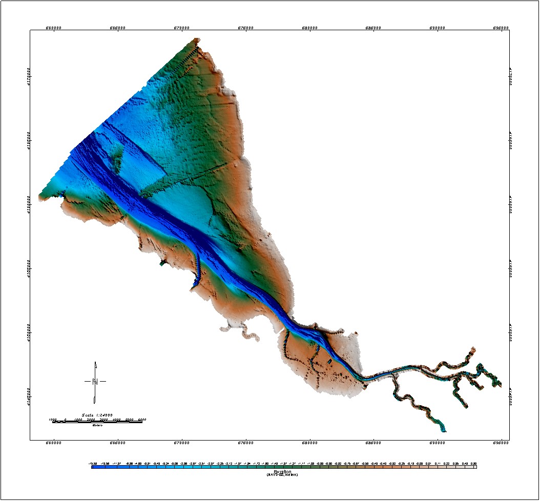
Sounding Chart for South SF Bay
Sounding Chart for South SF Bay
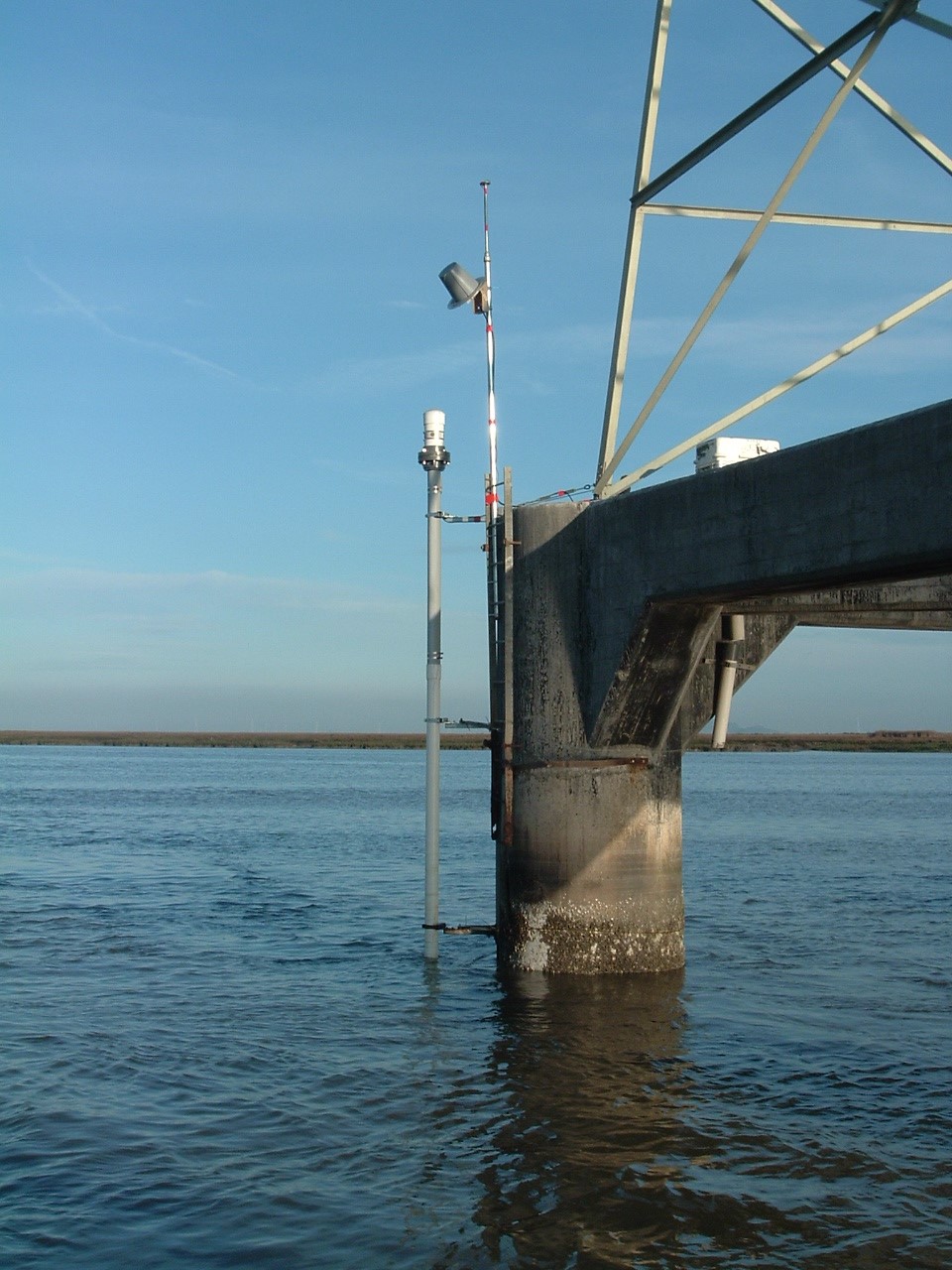
NOAA Tide Gauge
NOAA Tide Gauge

Seabed Classification
Seabed Classification
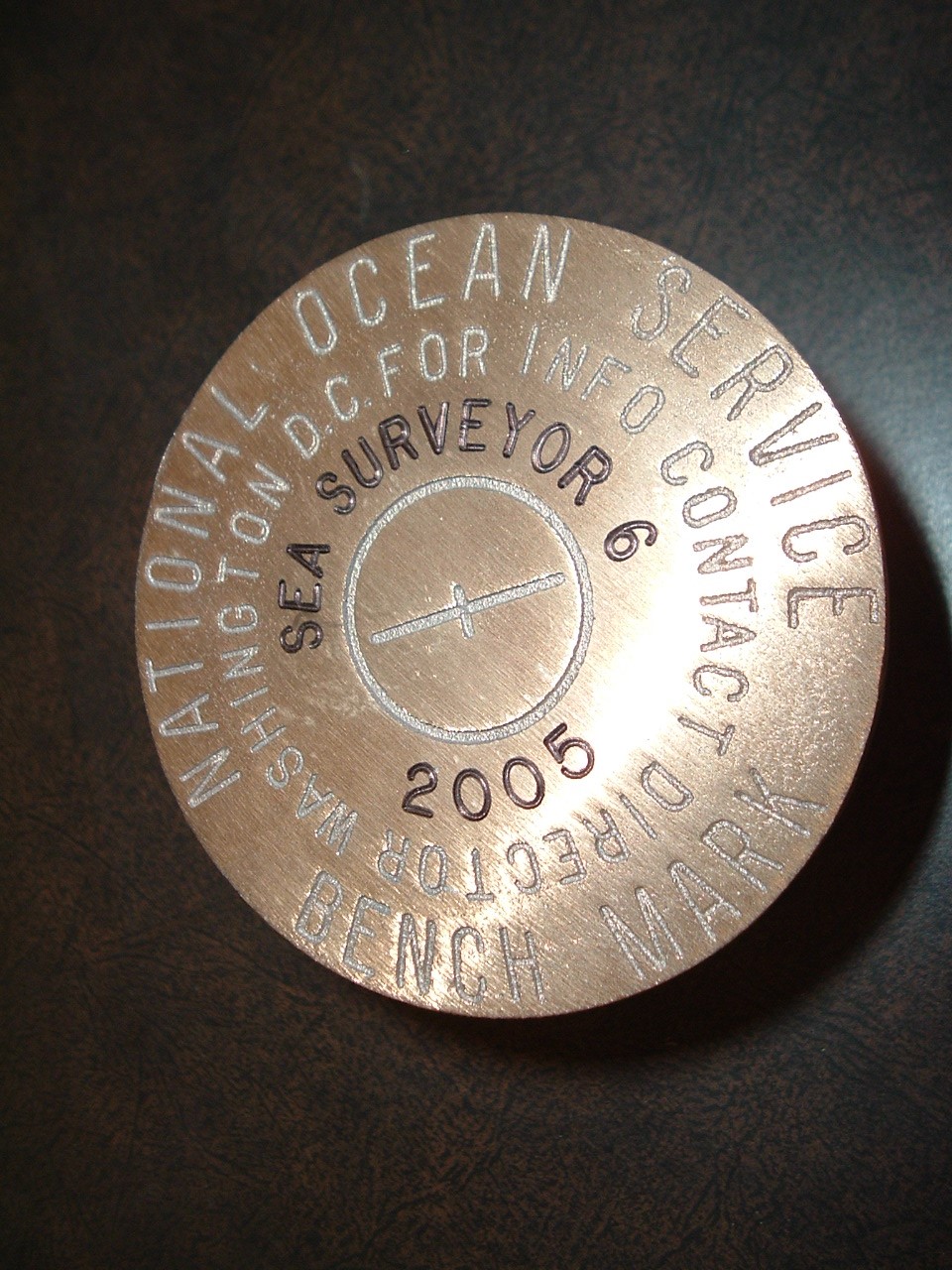
Tidal Benchmark
Tidal Benchmark

Tide Zones for South SF Bay
Tide Zones for South SF Bay