
Completion Date: 2000
Contract Value: $120K
Chevron Pipeline Company transports aircraft fuel to Sacramento Airport through an 8”-diameter pipeline buried beneath the 7-mile wide Sacramento Delta. At 5-year intervals (1987, 1992, and 1997), Chevron Pipeline contracted Sea Surveyor to map the pipeline’s location and depth-of-burial as it crossed the Delta, the Deep Water Ship Channel, and several sloughs. A subbottom profiler used seismic reflection techniques to locate the buried pipeline and determine its burial depth. Divers used “jet probes” to directly measure the pipe’s depth-of-burial at selected locations to calibrate the seismic reflection data. A Class 1 hydrographic survey mapped the elevation of the seafloor over the pipeline.
The pipeline was exposed by scour during the 1998 El Nino flood and damaged when struck by a ship’s anchor. Sea Surveyor provided emergency survey services to Chevron Pipeline Company, and located the exposed pipeline and ship’s anchor. Sections of the pipeline had been damaged by the ship’s anchor, dragged out of its trench, and were unsupported above the seafloor. Sea Surveyor provided navigation services to divers and contractors that recovered the anchor, repaired the pipeline, and covered the exposed pipeline with protective rock armor.
Services provided include:
- Locating buried pipe using Marine Magnetometer.
- Subbottom Profiling to determine pipe’s depth-of-burial.
- Search and recovery of Ship’s Anchor using side-scan.
- Inspection of armor rock placement by hydro surveys.
- Precision navigation services using differential GPS.
In 1999-2000, Sea Surveyor provided precision navigation
services to assist a contractor that used directional
drilling techniques to install a new pipeline across the
Deep Water Ship Channel.
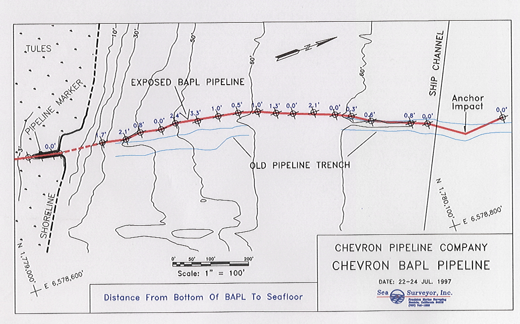
image007
Seafloor Features Map showing Pipe Spans and Anchor.
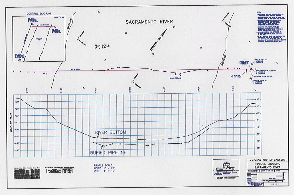
image009
Chart and Profile of Pipe crossing under Ship Channel.
image004
Subbottom Profiler

image005
Pipe in Subbottom Record