
Contract Value: $190K
A/E Contract Value: $1 Million
Under contract to the San Francisco District, Corps of Engineers, Sea Surveyor conducted a highly-detailed
geophysical survey of five (5) geological features that pose a hazard-to-navigation to deep-draft vessels entering
San Francisco Bay. The 5 submerged hazardous rocks are located in Central San Francisco Bay between the
Golden Gate Bridge and Alcatraz Island, and include:
• Harding Rock
• Shag Rocks
• Arch Rock
• Blossom Rock, and
• Golden Gate Mound
Sea Surveyor mapped the submerged rocks and prepared detailed
bathymetric contour charts, geologic cross-sections, and isopach
maps showing the thickness of sediment layers. The submerged
rocks were mapped using the following geophysical sensors:
• Multibeam Sonar and Survey-Grade Depthfinder,
• Side-Scan Sonars (100 kHz and 600kHz)
• Two types of Subbottom Profilers
• Seismic Refraction Surveys
• Marine Magnetometer
The Seismic Refraction Survey, which measures the velocity of sound
passing through the rocks to estimate their density, determined
Golden Gate Mound to be unconsolidated sand rather than rock.
A comprehensive Marine Archaeological Survey found a sunken 200’
barge at Blossom Rock, and rock anchors drilled into Shag Rocks
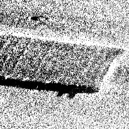
Side-Scan Image of Sunken Barge
Side-Scan Image of Sunken Barge
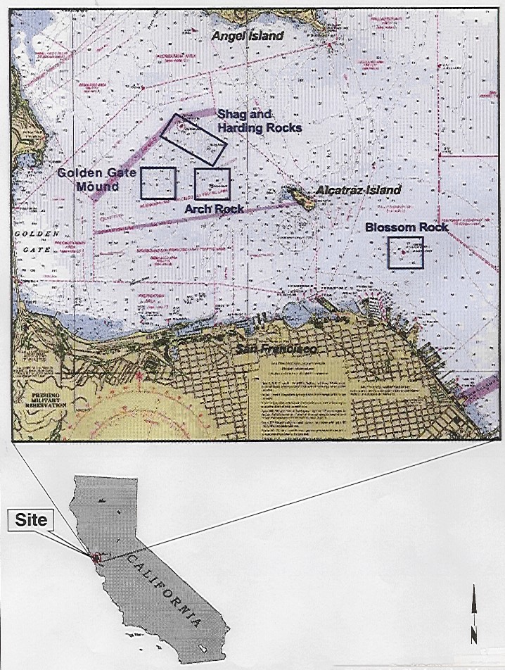
Location of Hazardous Rocks in SF Bay
Location of Hazardous Rocks in SF Bay
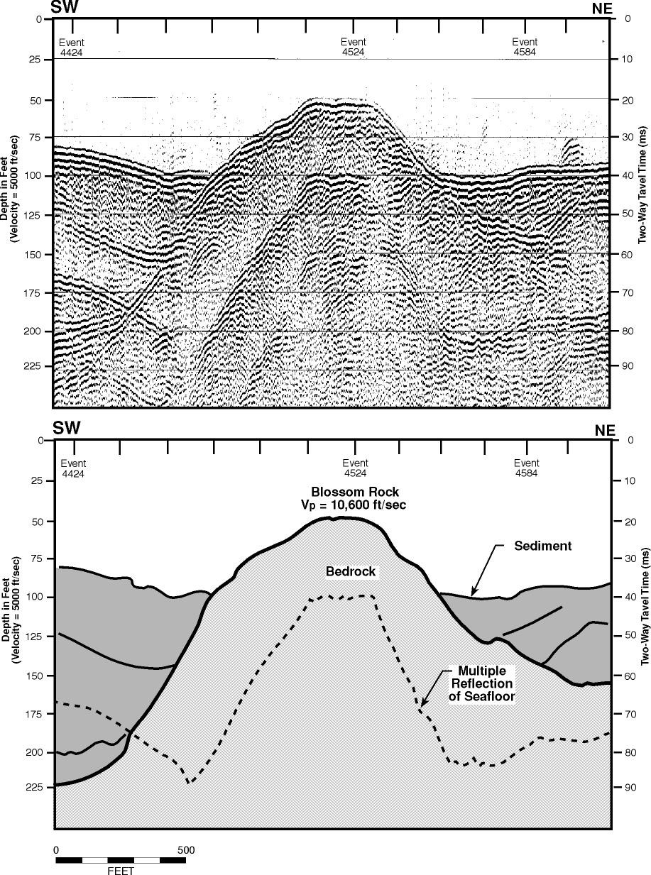
Geologic X-Section over Blossom Rock
Geologic X-Section over Blossom Rock
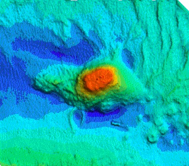
3-D Multibeam Image of Blossom Rock
3-D Multibeam Image of Blossom Rock