
Completion Date: 2012
Contract Value: $120K
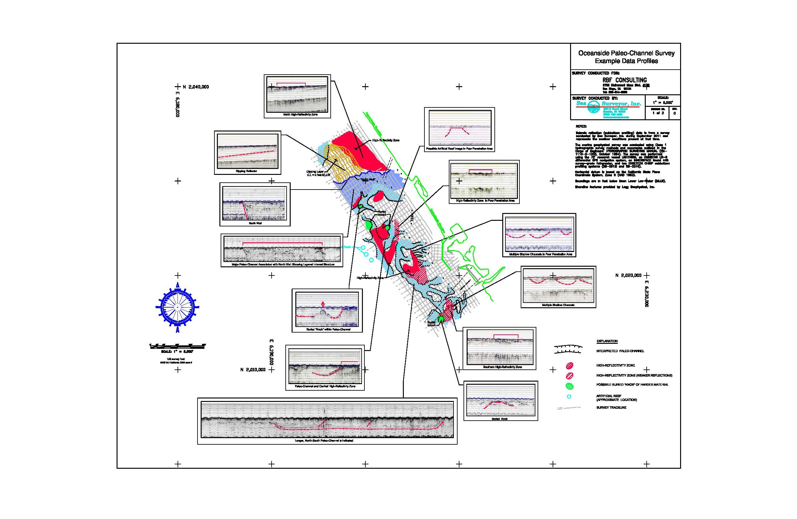
In 2011, Sea Surveyor, Inc. conducted a seismic reflection (subbottom profiling) survey of a 1-mile (offshore) x 4-mile (alongshore) area at the U.S. Marine Corps Base, Camp Pendleton (San Diego County) in support of a proposed seawater desalination plant. The purpose of the survey is to map the buried paleochannels from the San Luis Rey and Santa Margarita Rivers. Maps from the survey were used by engineers for selecting desalination plant location, undersea pipeline design, and buried intake feasibility.
Sea Surveyor conducted the seismic reflection survey using two (2) sizes of CHIRP subbottom profilers towed behind our 72’ research vessel LIGHTNING. The 500-lb SB-0512 towfish penetrated 40’-50’ into the subbottom, while the 200-lb SB-216 towfish provided high-resolution acoustic images of the stratigraphy in the upper 30’.
Sea Surveyor prepared a bathymetric contour map referenced to NAVD-88 elevation. The seismic reflection chart is referenced to the NAVD-88 vertical datum and shows the buried paleochannels of the Santa Margarita and San Luis Rey Rivers.
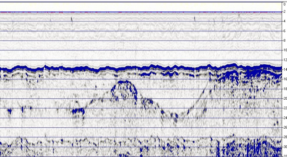
Isopach (sediment thickness) map with example cross-sections
Isopach (sediment thickness) map with example cross-sections
South bank of San Margarita River paleo-channel, with San Mateo Formation at left
South bank of San Margarita River paleo-channel, with San Mateo Formation at left
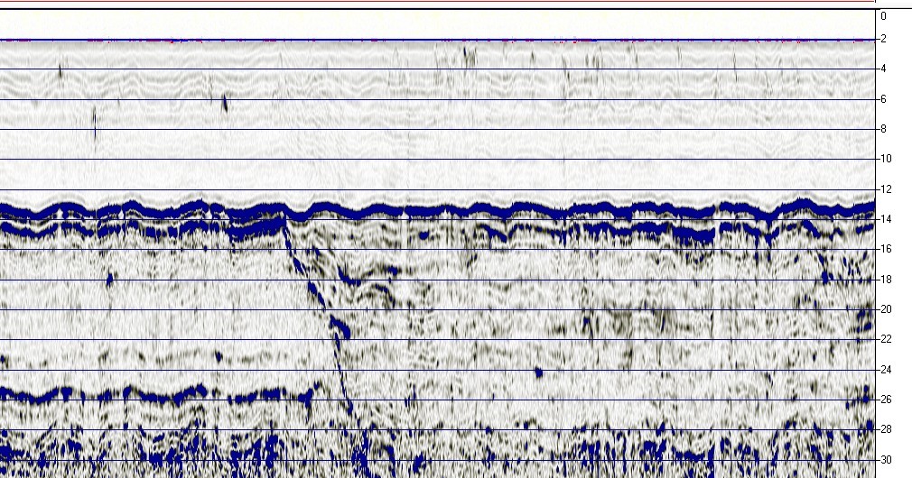
Subbottom profile of San Luis Rey River’s buried paleochannel
Subbottom profile of San Luis Rey River’s buried paleochannel
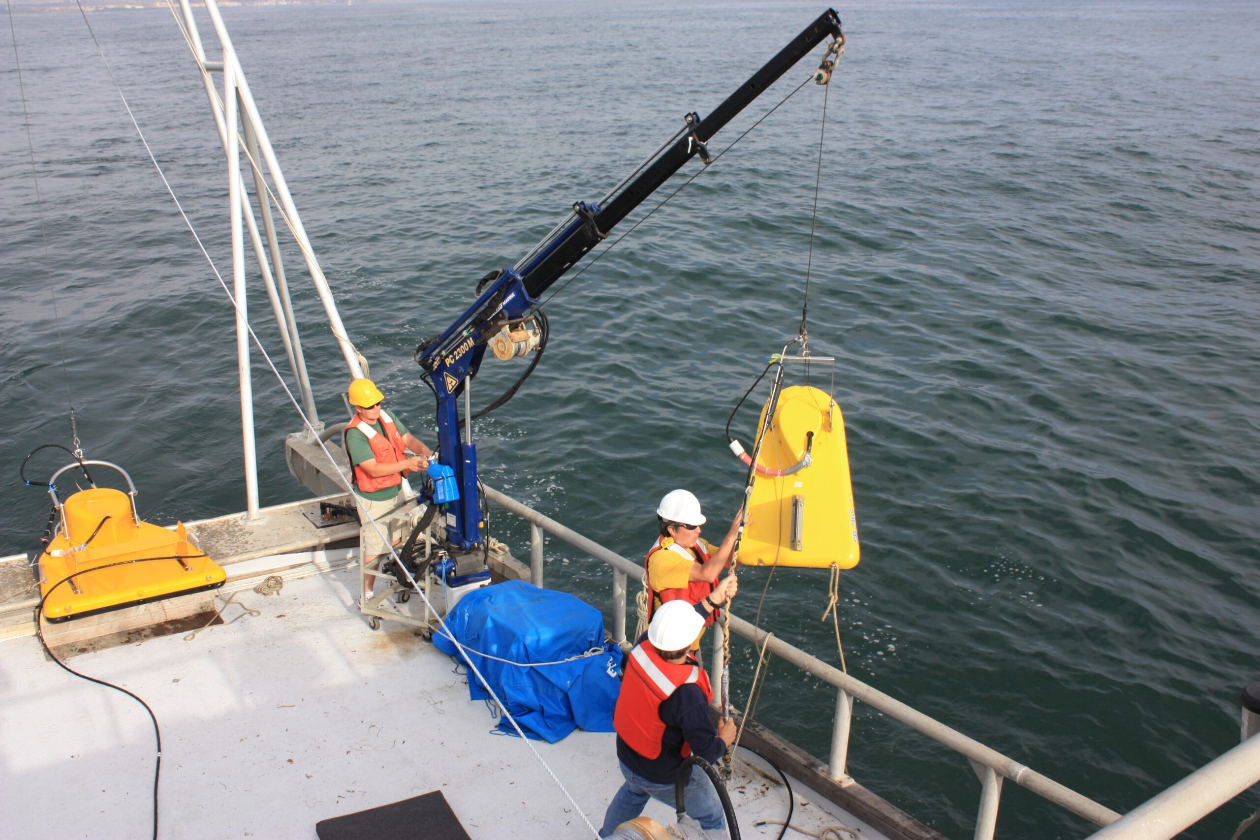
Two CHIRP towfish are deployed from RV LIGHTNING using crane & A-frame
Two CHIRP towfish are deployed from RV LIGHTNING using crane & A-frame