
Completion Date: 2012
Contract Value: $ 664K
As part of an IDIQ contract with the US Army Corps of Engineers, Sea Surveyor, Inc. completed a Comprehensive Evaluation of Project Datums (CEPD) at Noyo Harbor in Fort Bragg, California. The objective of the CEPD is to ensure that coastal engineering projects are based on reliable elevations, and permanent benchmarks are available at an adequate density and accuracy relative to the National Spatial Reference System.
First, Sea Surveyor completed the primary objective of the investigation, measuring the elevation of sealevel in Noyo Harbor for 3-months and computing the new tidal datums to NOAA standards. Then, Sea Surveyor conducted detailed surveys of the jetty, Federal navigation channel, and offshore dredged material disposal site and prepared a comprehensive series of maps referenced to the new tidal datums.
The scope of work for the Noyo Harbor CEPD project included:
1) Establish geodetic survey control to requirements in USACE Comprehensive Evaluation of Project Datums (EC 1110-2-6070, 2009).
2) Monitor sealevel for 3-months and compute tidal datums to NOAA standards,
3) Establish five (5) new tidal benchmarks around Noyo Harbor,
4) Multibeam sonar mapping of jetty and Federal navigation channel,
5) Side-scan sonar survey of jetty and preparation of side-scan mosaic showing the location and placement of armor rock.
6) Monitoring of ocean currents and waves at offshore disposal site using ADCP,
7) Monitoring of turbidity and suspended sediment at offshore disposal site.
8) Sediment sampling and laboratory testing of sediments collected in Federal
Navigation channel and offshore disposal site for compatibility analyses.
9) Multibeam sonar survey of offshore disposal site and preparation of Marine
Benthic Habitat Map.
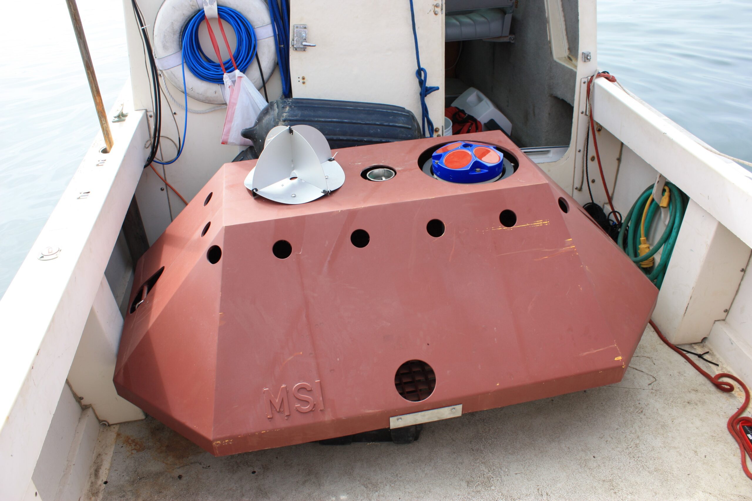
ADCP in trawl-resistant mooring measured currents and waves
ADCP in trawl-resistant mooring measured currents and waves
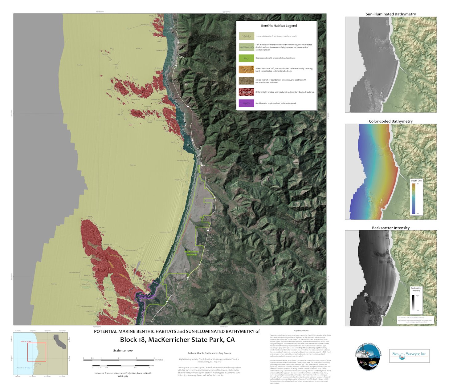
Benthic Habitat Map
Benthic Habitat Map

Vibracore sampling in Noyo Harbor
Vibracore sampling in Noyo Harbor
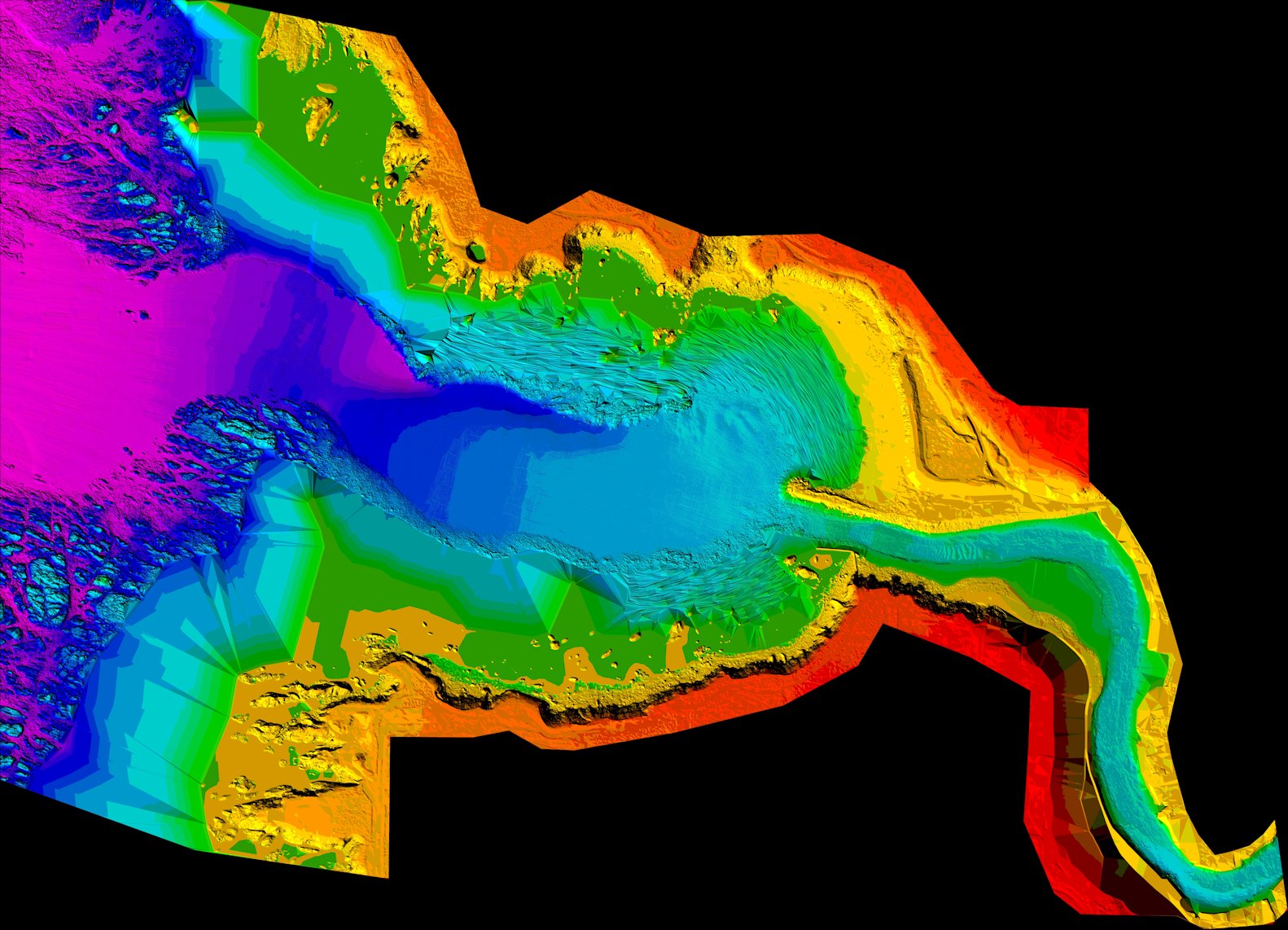
Multibeam Sonar Map
Multibeam Sonar Map
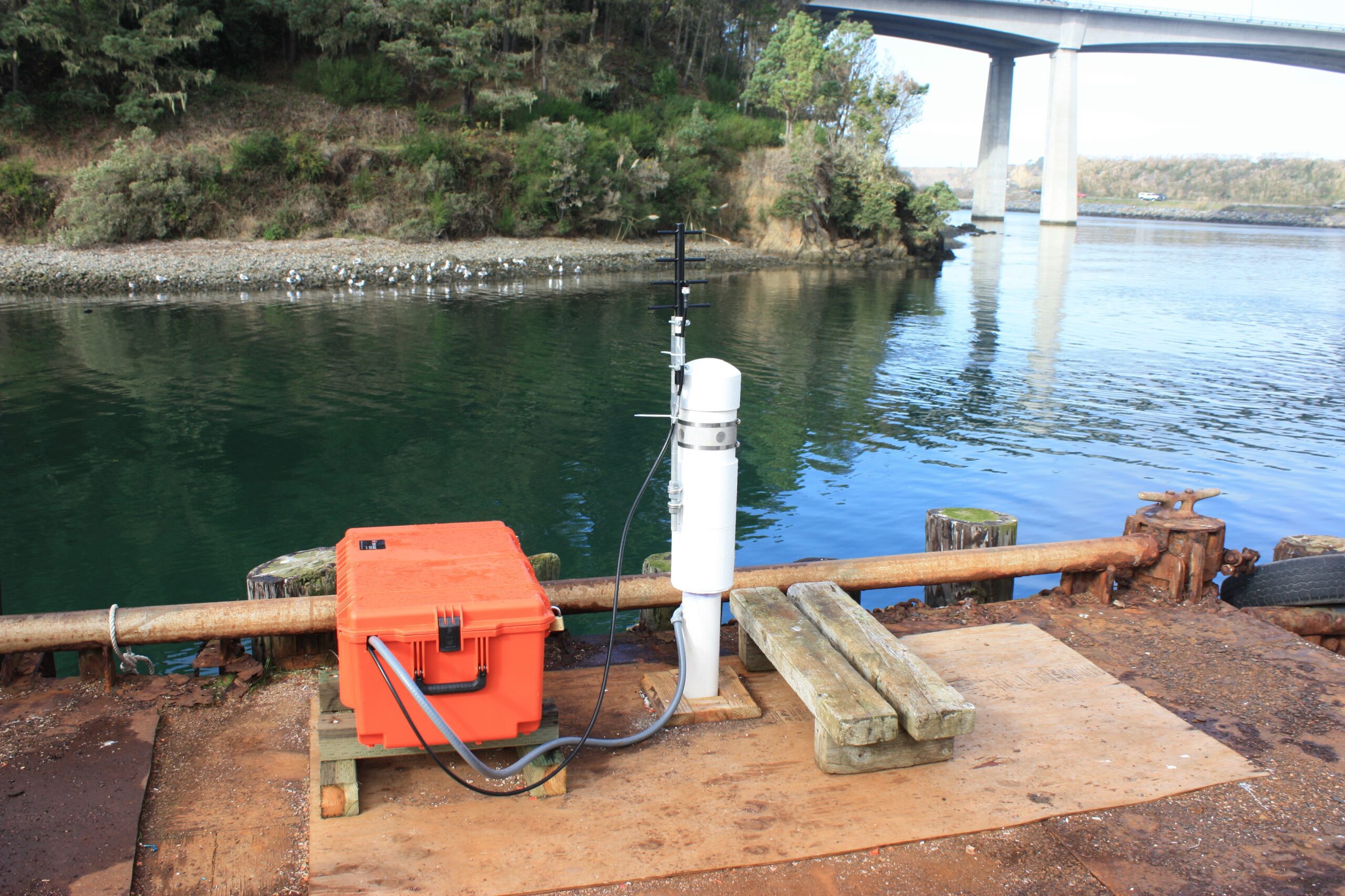
NOAA Tide Station
NOAA Tide Station