
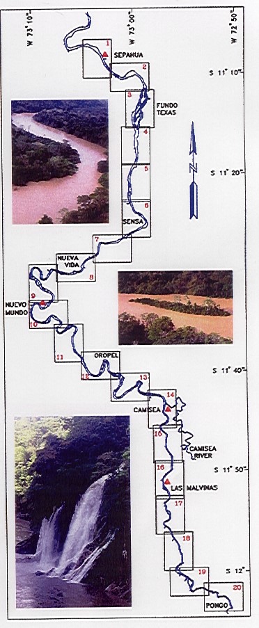
Map of Overlapping Navigation Charts for the Urubamba River
Sea Surveyor conducted the first survey of the previously uncharted Ucayali and Urubamba Rivers in the Amazon
Region of Peru. The purpose for the survey was to map 400-miles of natural river channels and prepare Navigation
Charts that would allow tugs and barges to reach the natural gas fields discovered in the eastern Andes Mountains.
Sea Surveyor designed a 35′ survey boat and supervised its construction in a Peruvian shipyard. After accepting
delivery of the survey boat, one of our surveyors helmed the boat upriver over 1,000 miles to reach the
survey area. Our surveyor lived aboard the survey boat for 3-months while accomplishing the following tasks:
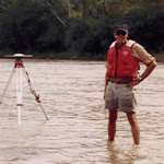
• Installed 8 water level recorders on the river bottom at 50-mile intervals that continuously monitored the
river rise and fall,
• Established the first permanent benchmarks in the Peruvian Amazon and determined their elevations using
advanced GPS techniques over a 1,200-mile baseline,
• Completed a detailed hydrographic survey of 400-miles of the Ucayali and Urubamba Rivers, and identified
the location and depth of the natural deep channels,
• Prepared the first series of navigation charts for upper Amazon tributaries with soundings referenced to a
common River Datum.
Mapping the River with Fast-Static GPS
Using a satellite telephone, the survey data was transmitted from the Peruvian Amazon to Sea Surveyor’s U.S. office,
where the navigation charts were prepared daily. Sea Surveyor used the bathymetric charts to design a navigation
channel that allowed tugs to avoid shoals by following the natural river channel.